Science and technologies are fundamental to the Jane Goodall Institute, and our Conservation Science team ensures we have the best tools for observing, collecting, analyzing, and sharing new knowledge and insights to support our mission across all programs.
JGI’s Conservation Science’s Objectives
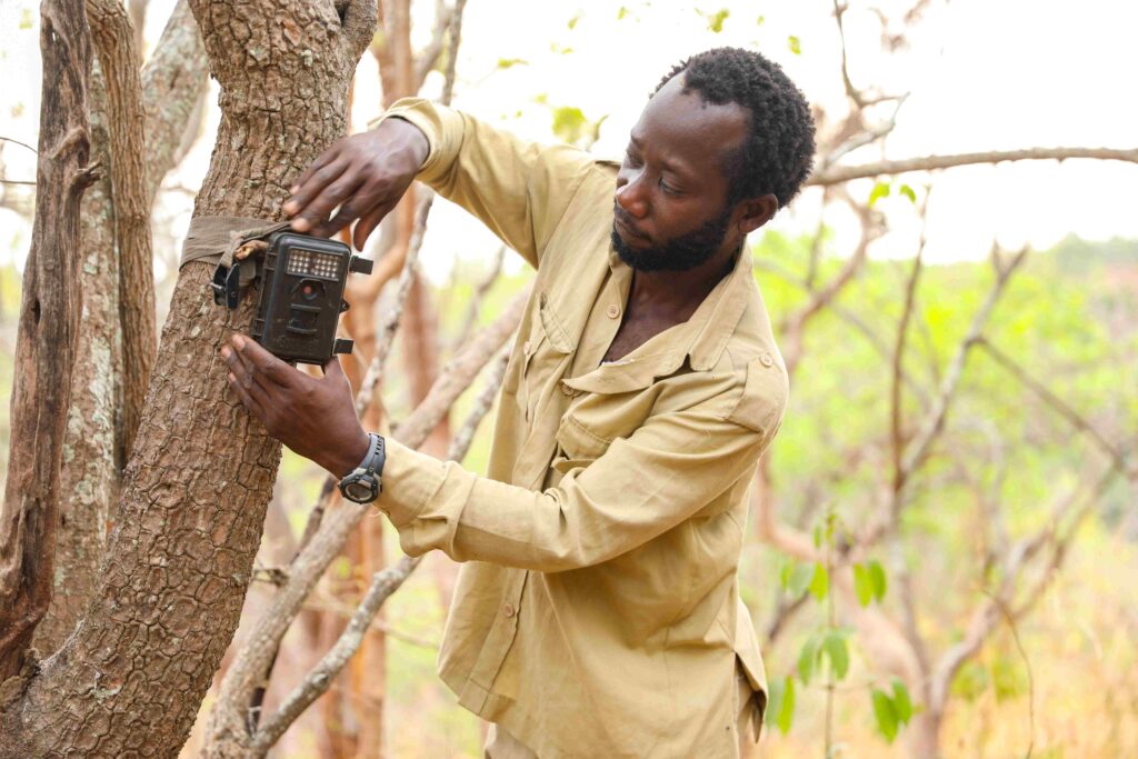
Continuously expand the understanding of chimpanzee behavior, habitats, and threats using long-term research and innovative technologies.
Use data and scientific insights to develop and implement effective, data-driven conservation solutions that address the convergence of climate change, biodiversity loss, and people’s livelihoods.
Infuse science into community-led efforts, enabling local people to make informed, compassionate decisions about their natural resources and development needs.
Explore and develop tools with cutting-edge technologies such as AI and remote sensing to solve the world's toughest conservation challenges at scale.
Putting information and innovative technologies in the hands of local people is an important part of our Tacare approach to community-led conservation. This allows communities to make informed decisions that better support both their wellbeing and the health of the ecosystems they are part of. One example is the impact of our Village Forest Monitor (VFM) program, first launched in Tanzania in 2005 and now one of the longest- running citizen science programs in Africa to use mobile and cloud technologies.
Through this program, JGI staff train locally selected community members to regularly monitor their local forest reserves. VFMs use mobile app technology, such as ArcGIS’s Survey123 platform, to note changes in habitat health, biodiversity, and even illegal activity for swift local action. The program works: In 2024, a team of researchers confirmed that forest cover in monitored local village forest reserves increased, contributing to the regrowth of much of the forest habitat surrounding Gombe National Park, the site of Dr. Jane Goodall’s landmark research.
That’s the power of Tacare — combining local perspectives with geospatial technology for lasting impact.
We leverage advanced science and technology to maximize the impact of our wildlife research and conservation work.
We use a combination of high-resolution satellite imagery, drones, and geographic information systems (GIS) technologies to map chimpanzee range and movements, monitor forest health, track deforestation in near real-time, observe human impacts on wildlife habitats, and inform Roots & Shoots youth projects.
We train a variety of conservation stakeholders — including local community monitors, government employees, and partners — to use smartphones and other mobile data collection tools and apps to collect real-time information on threats like illegal hunting, allowing for a rapid and targeted response.
We are pioneering the use of bioacoustics, camera traps, e-DNA and AI to monitor wildlife in key chimpanzee habitats — especially the Greater Gombe Ecosystem. Non-invasive audio and visual sensors record images and soundscapes, and AI algorithms monitored by our experts analyze these data to gain insight into biodiversity and behaviors.
We are expanding machine learning and AI models to analyze vast datasets, including millions of handwritten notes and video footage from over 65 years of chimpanzee research, to identify individual chimpanzees and complex social behaviors for quicker analysis and deeper insights.
Our Gombe Stream Research Center One Health Laboratory houses cutting-edge equipment for on-site DNA analysis and pathogen screening. This allows for the precise detection and monitoring of disease-causing agents in wildlife, domesticated animals, and humans, helping to predict and manage potential zoonotic disease outbreaks.
The Village of Kigalye outside Gombe National Park, pictured here, exemplifies the impact that can be made in under two decades when the local community is emboldened to make sustainable decisions for both its people and its environment.
In 1972, the area now represented by the Kigalye Village Forest Reserve had over 900 acres of woodlands (70 percent of its total area), while in 2005 — when the village reserve was created — its woodlands had decreased to 385 acres, just 42 percent of the forested area recorded in 1972.
Kigalye implemented a land-use plan in its village forest reserve that minimizes farming, logging, and fires and allows Miombo woodlands (which are the most extensive habitats available to Tanzania’s chimpanzees) to regenerate naturally.
Through the work of JGI, funding partners, and the Tacare approach, 1.3 million acres of new protected areas were designated at the village and district levels, increasing the overall protection of chimpanzee range in Tanzania from 9% to 52% of the remaining chimpanzee range in Tanzania.
Download resources for more information, and explore our habitat viability map in detail.
Photo credits: Stephano Lihedule, Norman Jean Roy
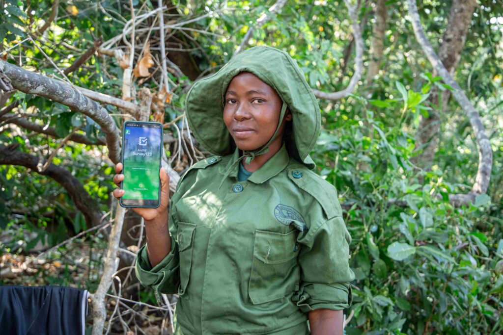
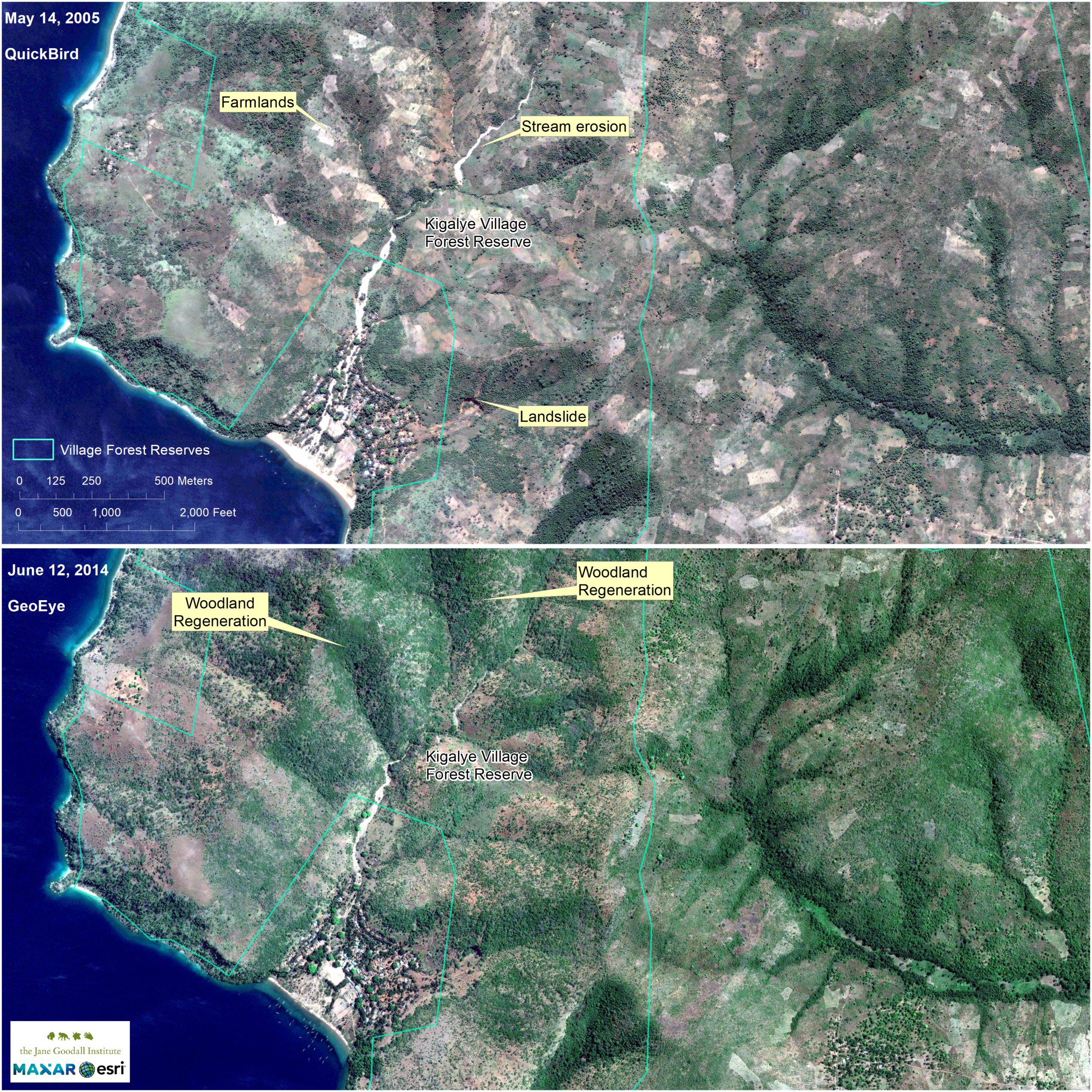
“These technologies allow teams, often in collaboration with local communities, to monitor chimpanzees, assess forest health, and identify threats in near real time. The results shape conservation plans and land use strategies that are practical, scalable, and grounded in evidence.”
— Dr. Lilian Pintea, Vice President of Conservation Science